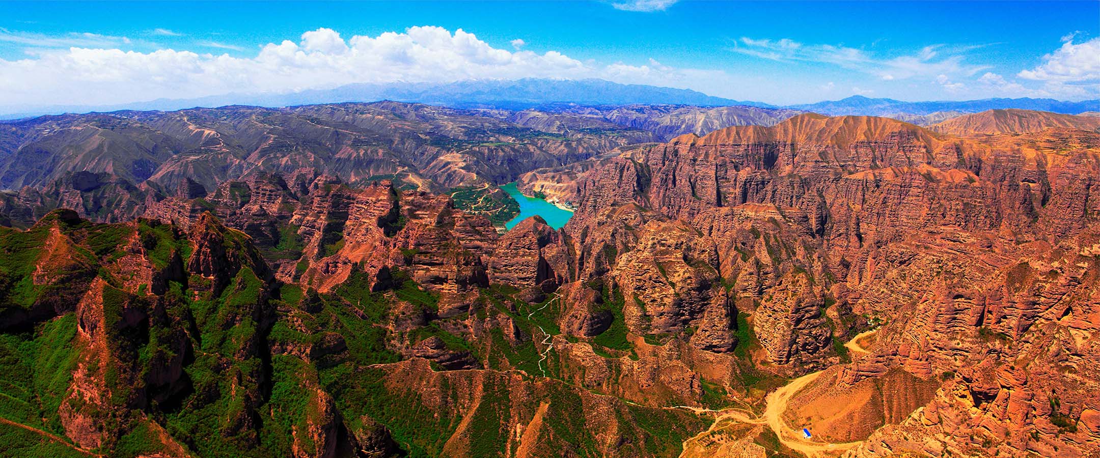
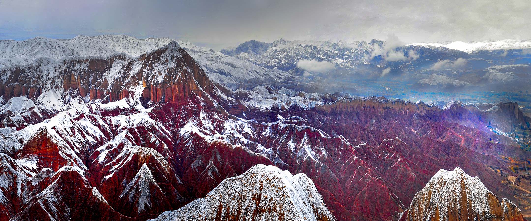
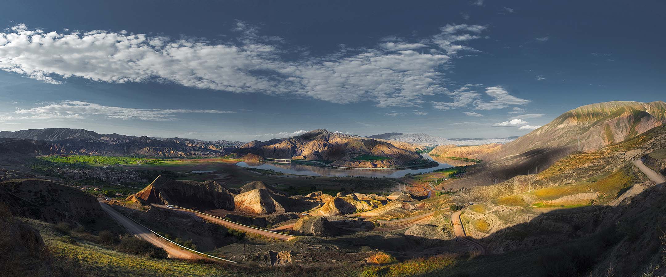


丹霞地貌主要分布于公园北部的黄河两岸,代表性遗迹点有 23 处。丹霞地貌的构成物质地层属下白垩系河口群,岩性为紫红色厚层砂砾岩、砾岩夹砂岩,产状近水平—缓倾斜,绝对海拔在 1950-2386m,相对高差一般在 50-100m 之间,最大高差达 300m 以上,无盖层。经水流切割、溶蚀、侵蚀和重力崩塌、风化剥蚀等综合作用下形成奇峰峭壁式的丹霞地貌。这里的地貌极具北方丹霞特色,一线天、巷谷、赤壁陡崖、峰丛、方山、石柱、残丘等丹霞发育的各个阶段的单体地貌景观丰富而典型,对丰富我国丹霞地貌类型研究内涵具有十分重要的科学意义。
丹霞峡谷:峡谷是指谷坡陡峻、深度大于宽度的山谷,通常发育在构造运动抬升和谷坡由坚硬岩石组成的地段。当切入地表很深,有近于垂直或十分陡峭的谷坡,谷地上下宽度几乎一致的又称为隘谷。谷地稍变宽,谷地两侧略有缓坡,倾角大于 60°的又称为嶂谷。公园的丹霞峡谷主要是隘谷和嶂谷。典型代表如大寺沟隘谷,谷坡高约 150m,谷宽约 10-20m,最窄处约 5m。
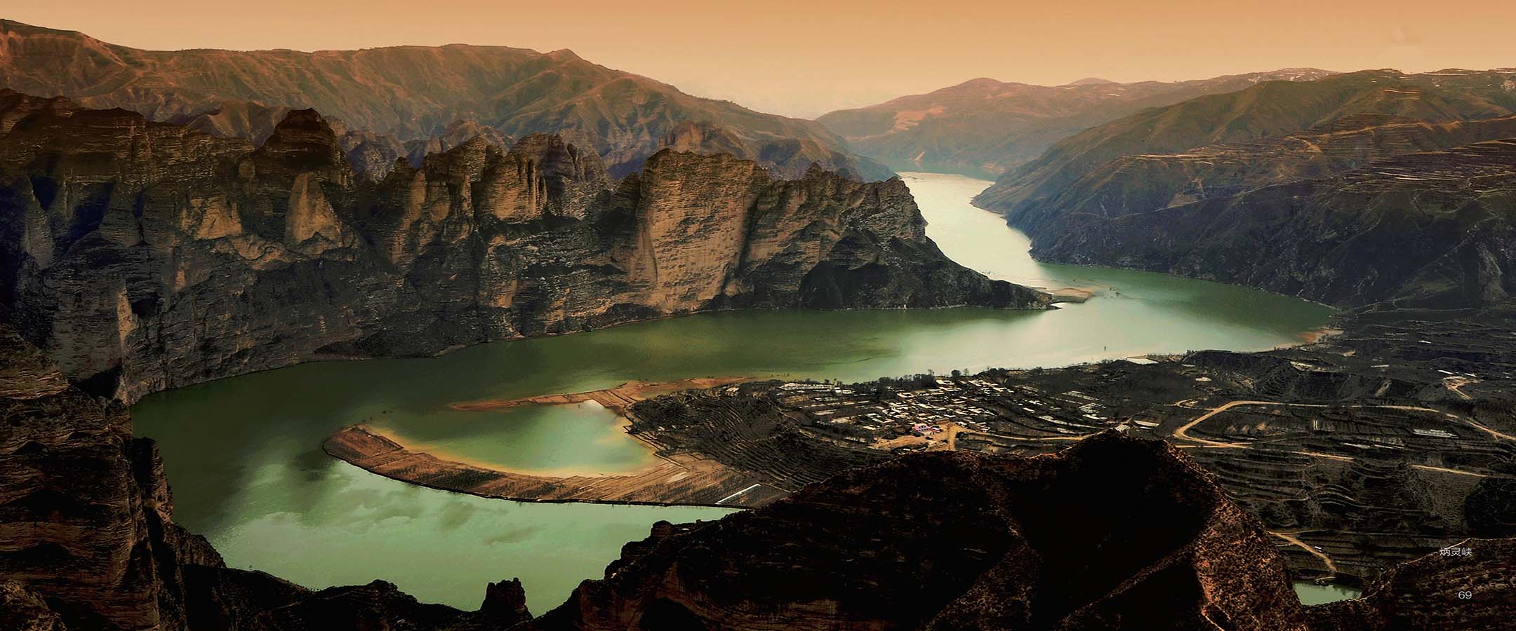
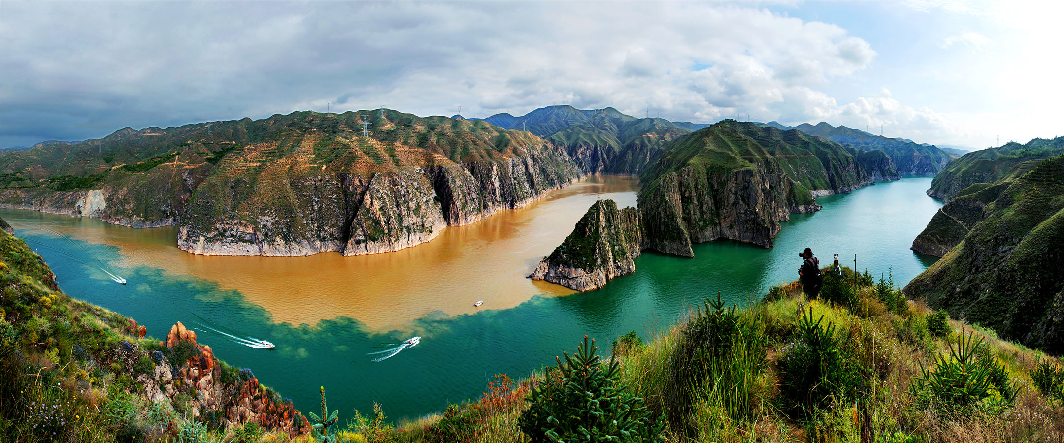
丹霞峰丛:是公园里分布最广的丹霞类型。公园丹霞峰丛分布于炳灵峡、邵家山等地,以炳灵丹霞峰丛(万笏朝天)最为典型。炳灵丹霞峰丛基座相连、峰顶分离,矗立于黄河岸边,与河水交相辉映,气势雄伟,状若万笏朝天。
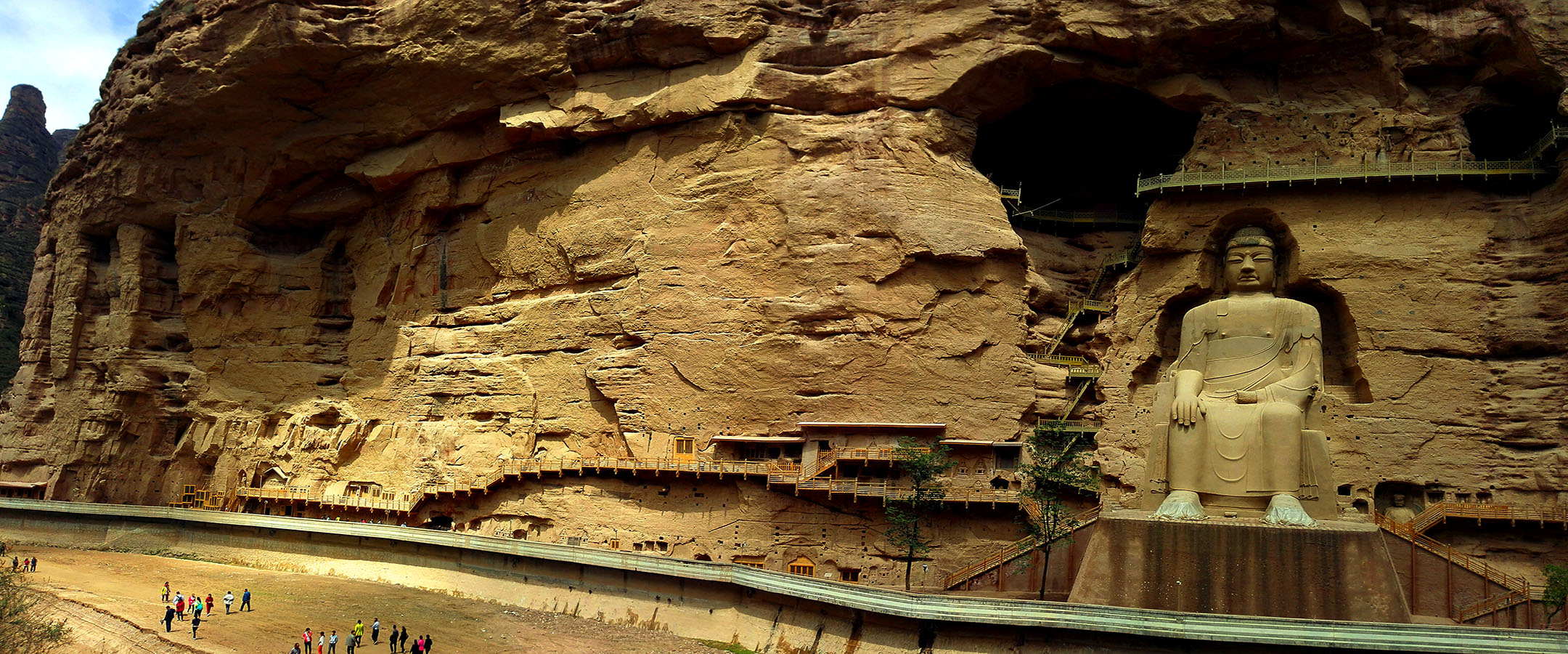
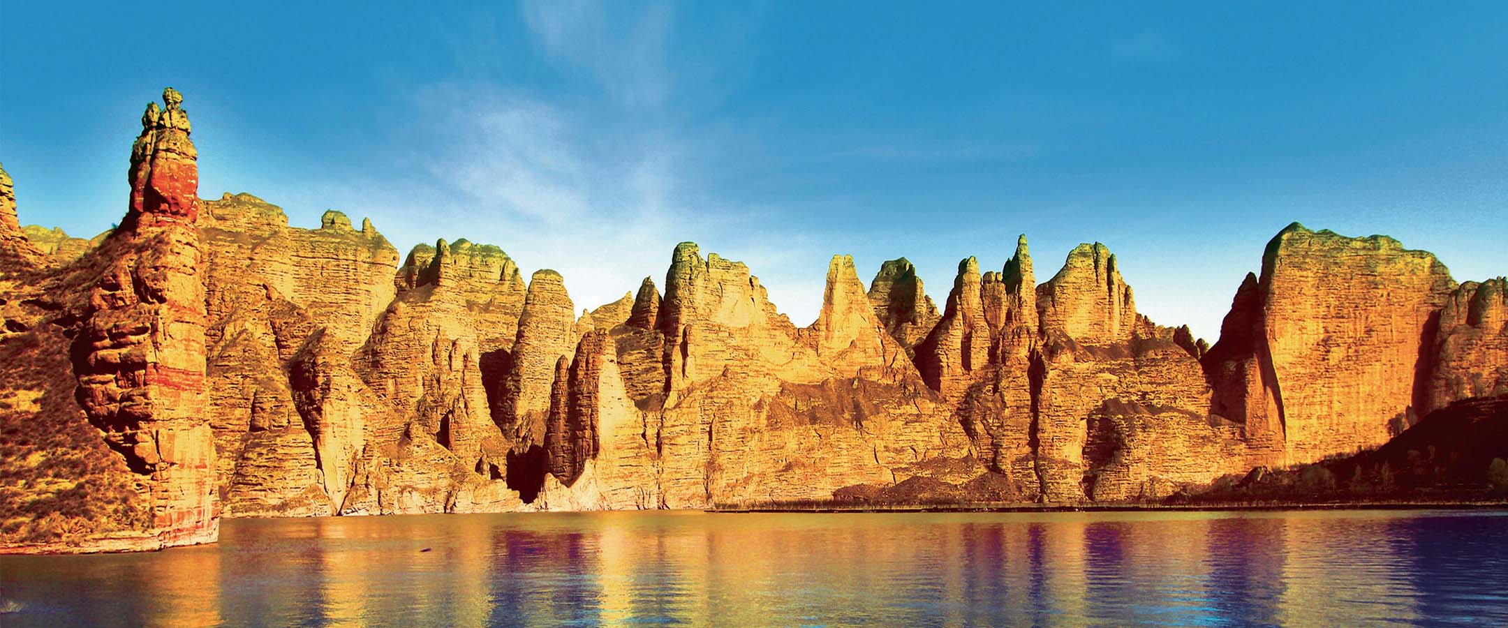
丹霞崖壁:为直立陡壁,大多在河流岸边或丹霞峡谷两侧分布,坡度大于 60°,高度一般大于 10m。往往因差异风化而形成千层糕状表面,顺层因风化作用发育洞穴。公园丹霞岩壁最为典型者如大寺沟佛翕状陡壁、直沟丹霞陡壁(百丈崖)、野核桃沟丹霞岩壁等。
丹霞方山:公园典型丹霞方山分布在直沟北侧,即直沟方山。其山顶较平缓,岩层近水平发育,四壁陡立,呈城堡状,长宽比小于 2:1。
丹霞石墙:丹霞石墙呈薄墙状发育,长度大于宽度 2 倍以上,高度大于宽度,往往顺断裂构造线延伸。公园发育丹霞石墙多处,以野核桃沟石墙(佛掌崖)最为典型。
丹霞石柱:为呈方形或圆形的孤立石柱,高度大于直径。由于其形态特殊,往往赋予美名并附会美丽传说。公园发育丹霞石柱多处,如大寺沟石柱(姊妹峰)、万佛沟丹霞石柱(文成进藏)等。
丹霞尖峰:丹霞尖峰四面发育陡坡,局部发育陡崖,山顶面不发育,整体呈锥状。公园丹霞尖峰分布广泛,著名者有万佛沟丹霞石峰(夏禹王峰)等。
丹霞洞穴:岩壁上广泛发育洞穴是公园丹霞石峰、石柱和崖壁的一个重要特征,成为岩壁景观重要的点缀。洞穴多呈蜂窝状,直径一般为 0.3-1.0m,深度多为 1.0m 左右,分布密度一般为 1-3 个/m2。部分洞穴穿透岩体,形成天窗、穿洞等奇特景观。广泛分布的洞穴还为鸟类提供了栖息场所,成为公园吸引鸟类安家的重要条件。
Danxia landform is mainly distributed on both sides of the Yellow River in the north of the geopark, with 24 representative geopoints (G32-G54 in table E.1.1-1). The strata of Danxia landform are the Lower Cretaceous Hekou group, whose lithology is purplish red thick glutenite and conglomerate interbedded sandstone, with near horizontal-gentle inclining occurrence. The absolute altitude is about 1950-2386 meters, the relative height difference is generally during 50-100 meters, and the maximum height difference is more than 300 meters. There is no caprock.
The Danxia landform dominated by strange peaks and crags is formed under the comprehensive action of water cutting, dissolution, erosion, gravity collapse and weathering erosion. The landform here has the characteristics of northern Danxia. There are abundant and typical individual geomorphic landscapes in various stages of Danxia development, such as thin strip of sky, lane valley, red steep cliff, peak cluster, Fangshan(mesa), stone pillars, monadnock and so on. It is of great scientific significance for enriching Danxia landform types research in China.
Danxia canyon: Canyon refers to the valley with steep slopes and its depth is bigger than the width. It is usually developed in the area where tectonic movement uplifted and valley slopes are formed by hard rocks. When it cuts into the earth’s surface very deep, there are nearly vertical or very steep valley slopes, and the width of the valley is almost the same as that of the gulley. The valley is slightly wider, with gentle slopes on both sides of the valley, and the dip angle bigger than 60° is also called narrow gorge. Danxia canyon in the geopark are mainly composed of gulley and narrow gorge. A typical example is the Dasigou Gulley, with a slope height of about 150 meters, the valley width about 10-20 meters and the narrowest point about 5 meters.
Danxia peak cluster: it is the most widely distributed type of Danxia in the geopark. Danxia peak cluster of the geopark is distributed at Bingling gorge, Shaojiashan and other places.Among them the most typical one is Bingling Danxia peak cluster (also named Heavenward tablets). Bingling Danxia peak cluster is characterized connected bases, separated peaks, and standing on the bank of the Yellow River. The momentum of them is majestic and it looks like thousands of heavenward tablets.
Danxia Cliff: it is a vertical steep wall, mostly distributed on the bank of the river or on the both sides of Danxia canyon, with a slope of more than 60 ° and a height of more than 10 meters. Because of the differential weathering, their surface looks like a cake of a thousand layers, and the caves are developed along the bedding due to weathering. The Danxia cliff is the most typical Danxia Landform in the geopark, such as Dasigou Danxia cliff with niches, Zhigou Danxia Cliff (also named Baizhang cliff), Yehetaogou Danxia cliff and so on.
Danxia Fangshan: the typical Danxia Fangshan(mesa) in the geopark is distributed in the north of Zhigou, named Zhigou Fangshan. The castle-shaped Fangshan’s top is flat with nearly horizontal rock layers, its walls are steep, and the ratio of its length to width is less than 2:1. Danxia wall: Danxia wall develops in the shape of thin wall, its length is more than 2 times of its width, its height is bigger than its width, and it often extends along the fault structural lines. There are many Danxia walls in the geopark, the Yehetaogou wall (also named Buddha's palm cliff) is the most typical one among them.
Danxia pillars: it is a square or circular isolated stone column with a height bigger than the diameter. Because of its special shape, it is often given a good name and accompanied by beautiful legends. There are many Danxia pillars developed in the geopark, such as Dasigou pillar (also named sister peaks), Wanfogou Danxia pillar (also known as Wencheng princess entering into Tibet) and so on.
Danxia peak: the steep slopes are developed on all sides of Danxia peak, and the scarps are developed partly. The overall shape of Danxia peak is conical. Danxia peak is widely distributed in the geopark, and the famous one is Wanfogou Danxia peak (also named King Yu peak) and so on.
Danxia cave: caves are widely developed on the rock wall, which is an important feature of Danxia peak, pillar, and cliff in the geopark. It becomes an important ornament of the cliff landscape. Most of the caves are honeycomb shaped, with a diameter of 0.3-1.0 meter, a depth of about 1.0 meter, and a distribution density of 1-3 cells per square meter. Some caves penetrate the rock mass, forming skylights, holes, and other strange landscapes. The widely distributed caves also provide a habitat for birds and become an important condition for attracting birds to settle down inthe geopark.
