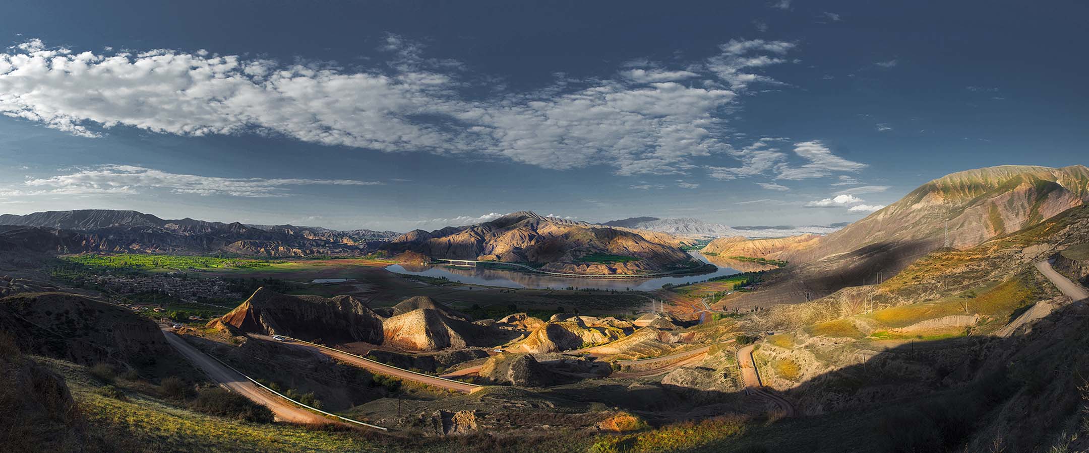


恩施大峡谷-腾龙洞世界地质公园位于东亚中国湖北省西南部的恩施土家族苗族自治州利川市、恩施市境内,公园西南起于利川市腾龙大桥2.6km处,东南至车坝河附近,北部靠近板桥镇与重庆交界处,南部在团堡镇境内。公园主体范围以清江为轴线由西南向东北展布,南北最大宽度约为41.11km,东西长约42.36km,总面积679.19km2。
恩施大峡谷-腾龙洞世界地质公园是以地质遗迹景观为主体,岩溶地貌和构造地貌类型为核心的大型地质公园。恩施大峡谷-腾龙洞世界地质公园地处扬子准地台的中部,上扬子和中扬子的交接处,属川鄂湘黔隆褶带北缘之一部分。园区保留了自寒武纪早期以来的海、陆相对完整沉积记录,并是中国南方亚热带岩溶地貌类型的代表地区之一。
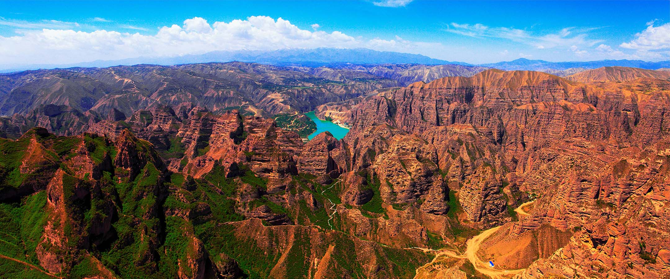
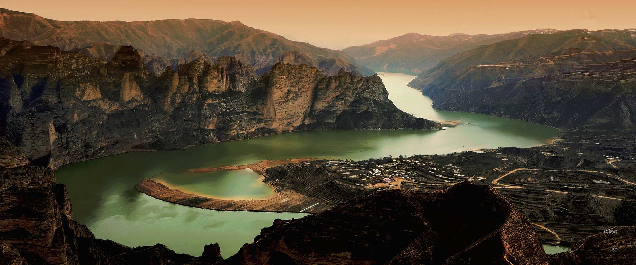
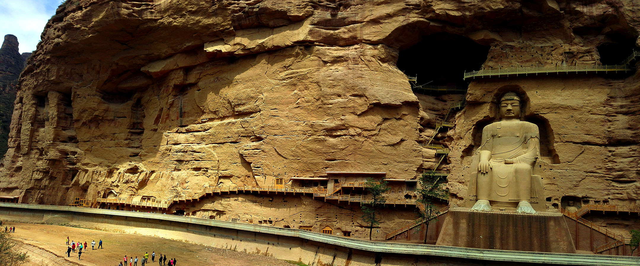
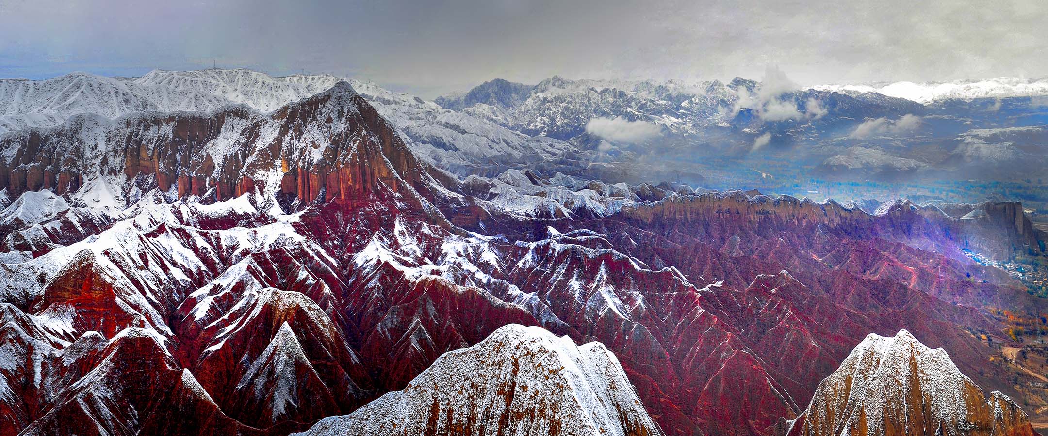
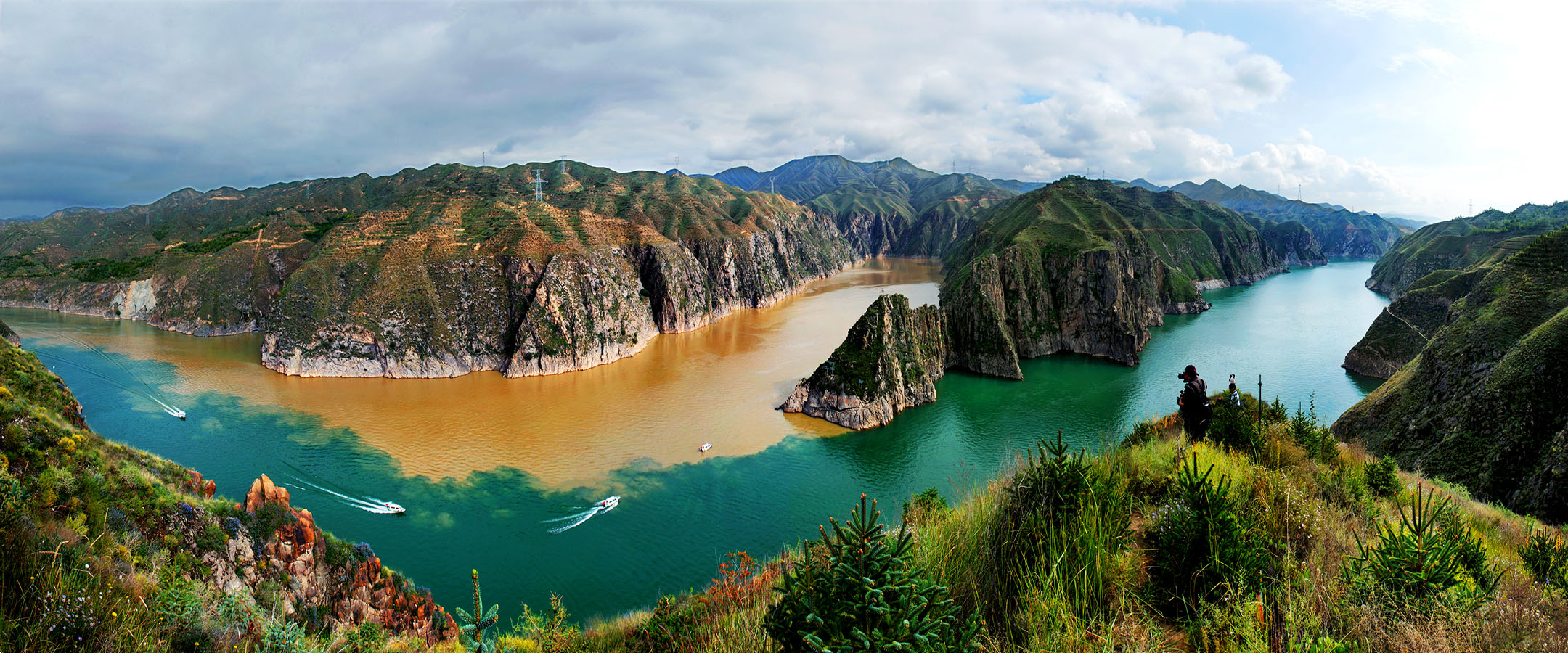
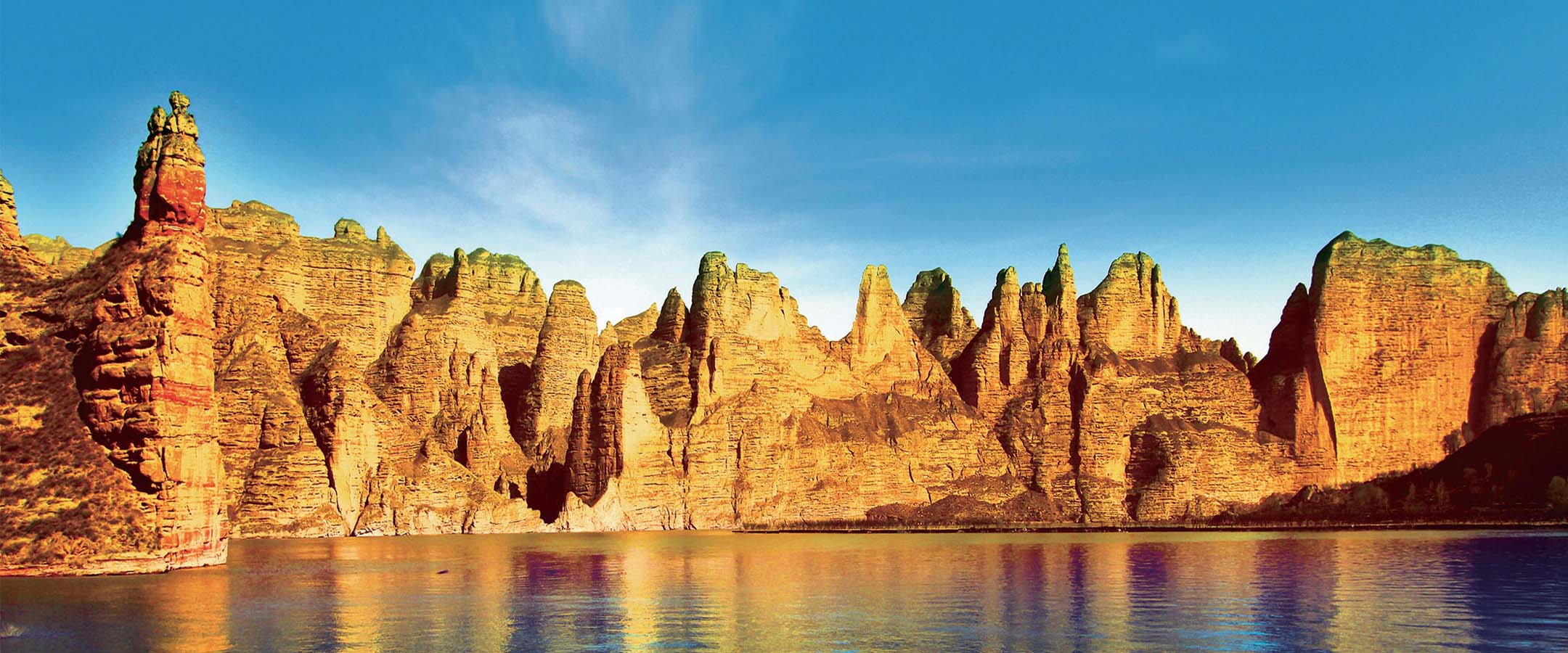
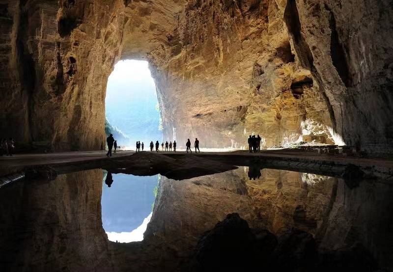
公园内发育有连续完整的显生宙地层古生物景观,典型的侏罗山式褶皱及相应的盆岭地貌景观,大型水系侵蚀形成的深切峡谷景观以及罕见的多层立体式岩溶景观,造就了精彩而丰富的地质遗迹资源。目前已知公园内重要地质遗迹79处,其中其中世界级3处、国家级15处、省级59处、省级以下2处。区内的清江伏流作为岩溶科学最具代表性的典型伏流,被引入《岩溶学词典》中,同时也是中国最大的伏流,乃是世界最大的伏流之一;而清江支流的云龙河,峡谷幽深,以“大地缝”而闻名于世。云龙河峡谷右岸顶部为七星寨石柱林、绝壁景观,左岸为沐抚岩溶台地。清江干流与支流云龙河在利川团堡与恩施接壤的两河口交汇,构成了大峡谷相连、交错,岩溶地貌发育等举世罕见的地质景观。
园区内丰富多彩的地貌景观对岩溶地貌学、现代地貌学、第四纪地质学等研究具有极大的科学价值。公园拥有的记录区域内地壳形成与演化的岩石、沉积建造和构造形迹,如褶皱和断裂;拥有的寒武纪以来的沉积、变形事件以及与之相关,尤其以二叠系—三叠系的沉积序列发育等。在漫长的地质历史长河中所形成的各种典型地质地貌景观、水体景观、地质灾害景观等都具有极其重要的地学研究价值和地质科普意义。此外,园区内丰富的古生物化石对研究地球生命演化、鄂西地区的古地理环境、古生态组成等具有重要科学意义。
恩施大峡谷—腾龙洞世界地质公园横跨恩施州的恩施市和利川两个县级行政区,公园内地质遗迹资源的自然组合分布相对集中。

恩施大峡谷—腾龙洞世界地质公园的总体结构为“一心四廊四区”,即:
一个接待中心:沐抚办事处是恩施大峡谷—腾龙洞世界地质公园的旅游资源集中区,可将其打造成游客接待中心。沐抚办事处距利川市市区28km,距恩施市市区30km。从鄂西南地区到此,极为便利。
四条地质遗产廊道:前三条是东西向的地质遗产廊道,其中第一条为腾龙洞洞穴探秘地质遗产廊道,从腾龙洞开始,沿清江古河床,途经穿洞群、观彩峡、独家寨以及雪照河峡谷,直达玉龙洞;第二条为团堡天坑群生态地质遗产廊道,从宜影古镇开始,途径响水洞天坑、多老河天坑、大瓮天坑等天坑群,穿过朝东岩大峡谷直达石板岭,并延伸至恩施市区;第三条为见天坝生物礁—石林地质遗产廊道,从利川市区开始,沿318国道,途径见天瀑布、见天坝生物礁石林、户外科普实践基地、见天村地质之家,直达长扁河峡谷。第四条则是南北向的地质遗产廊道——恩施大峡谷生态地质遗产廊道,通过242国道连接大峡谷和鹿苑坪等景区,318国道及242国道这两条交通主干线同时连通了地质公园内的主要区域及绝大部分地质遗迹保护点。
四大区域:腾龙洞卧龙吞江-暗河旅游区、恩施大峡谷云龙地缝旅游区、团堡天坑绝壁旅游区、见天坝古生物礁化石旅游区。
另外还包括:
四个地学精品:卧龙吞江、峡谷绝壁、清江河谷、化石礁体。
八种景观类型:地层剖面景观、构造剖面景观、古生物化石景观、重要岩矿石景观、岩土体地貌景观、水体地貌景观、构造地貌景观、地质灾害遗迹景观。
Enshi Grand Canyon-Tenglongdong Cave Geopark is located in Lichuan City and Enshi City, Enshi Tujia&Miao Autonomous Prefecture which is in the southwest of Hubei Province of China. It starts from Tenglong Bridge 2.6km away in Lichuan City in the southwest, to the southeast near Chebahe River. It is near the junction of Banqiao Town and Chongqing to the north, and in Tuanbao town to the south. The main part of the park is distributed along the axis of the Qingjiang River from southwest to northeast. With a maximum width of about 41.11km from north to south and a length of about 42.36km from east to west, it covers a total area of 679.19km².
Enshi Grand Canyon-Tenglong Cave Geopark is a large-scale geopark with geological site landscape as the main body and karst landforms and tectonic landforms as the core. The Geopark is located at the middle of Yangtze paraplatform, at the junction of the upper and the middle Yangtze plate, belonging to part of the northern edge of Sichuan-Hubei-Hunan-Guizhou fold belt. The Geopark has kept complete sedimentary records of marine and terrestrial facies since the early Cambrian period, and is one of the representative areas of subtropical karst landform in southern China.

The Geopark has developed continuous and complete Phanerozoic stratigraphic paleontological landscape, typical Jurassic folds and corresponding basin ridge geomorphic landscape, deep canyon landscape formed by large-scale water erosion and rare multi-layer three-dimensional karst landscape, creating wonderful and rich geological site resources. At present, the Geopark has 79 important geological sites, including 3 world-class, 15 in national level, 59 in provincial level and 2 below provincial level.
In addition, it also includes four fine geological scenic sites: Wolongtunjiang Waterfall, canyons and cliffs, Qingjiang River Valley, and Fossil Reef.
There are eight landscape types: stratigraphic profile landscape, structural profile landscape, paleontological fossil landscape, important rock ore landscape, geotechnical landform landscape, water landform landscape, structural geomorphological landscape, and geological disaster site landscape.
