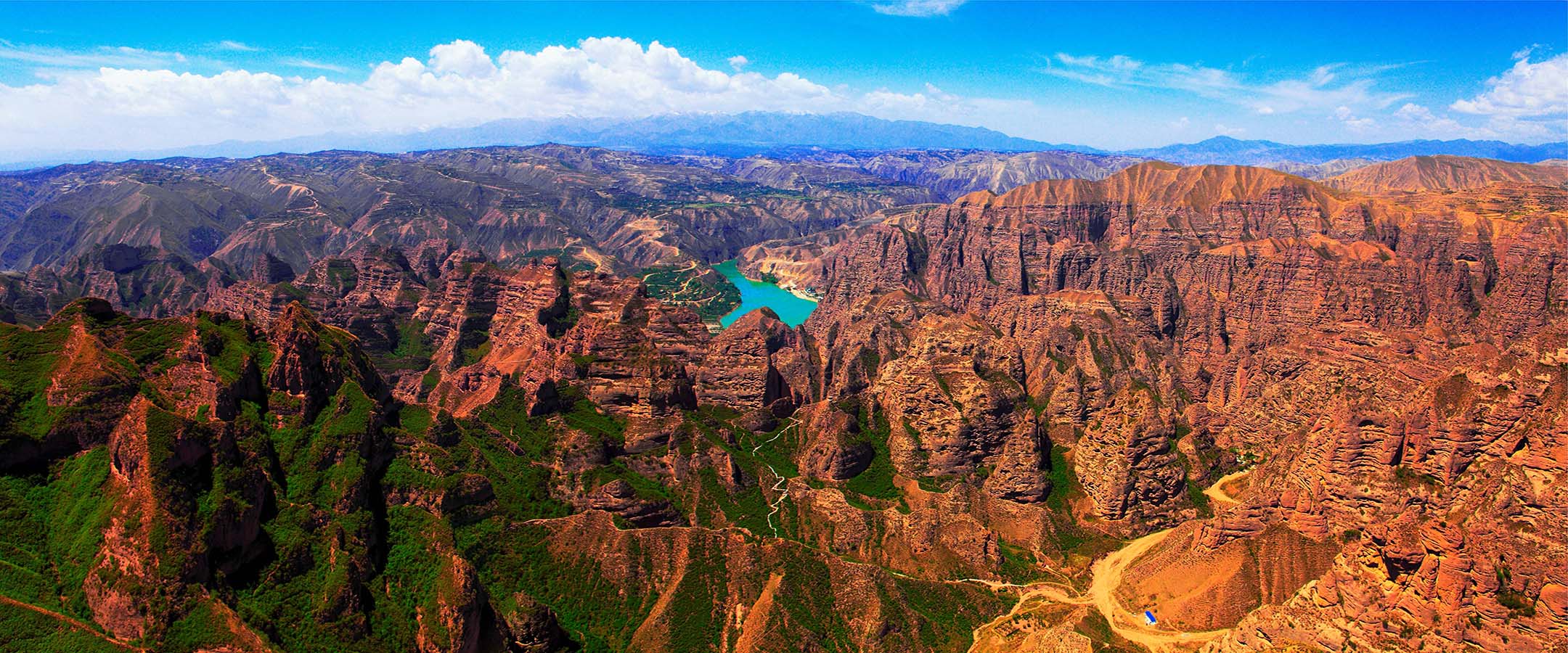
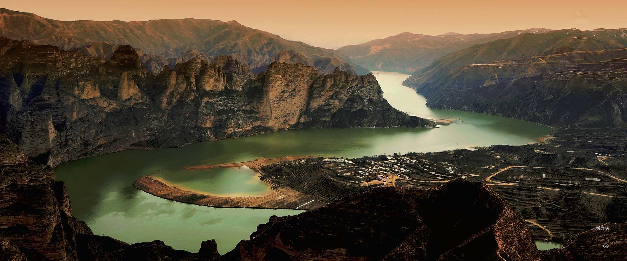
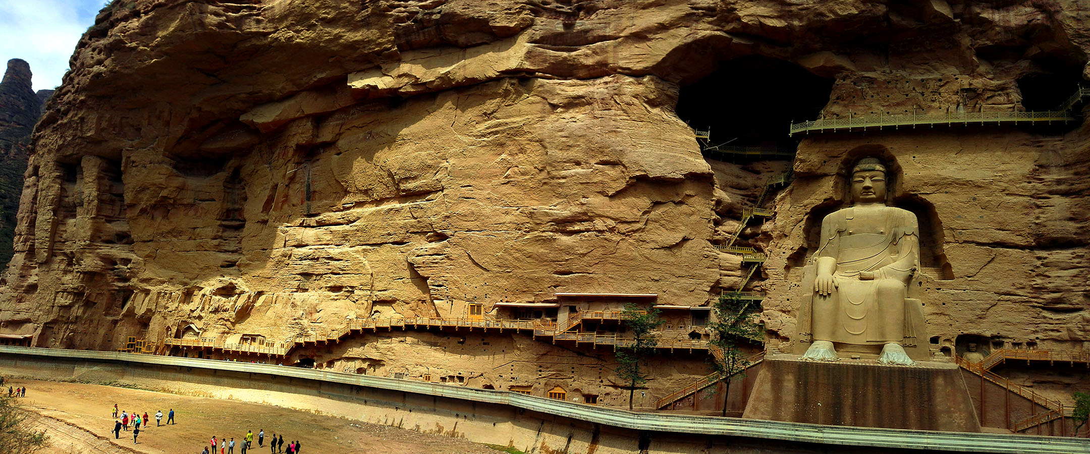
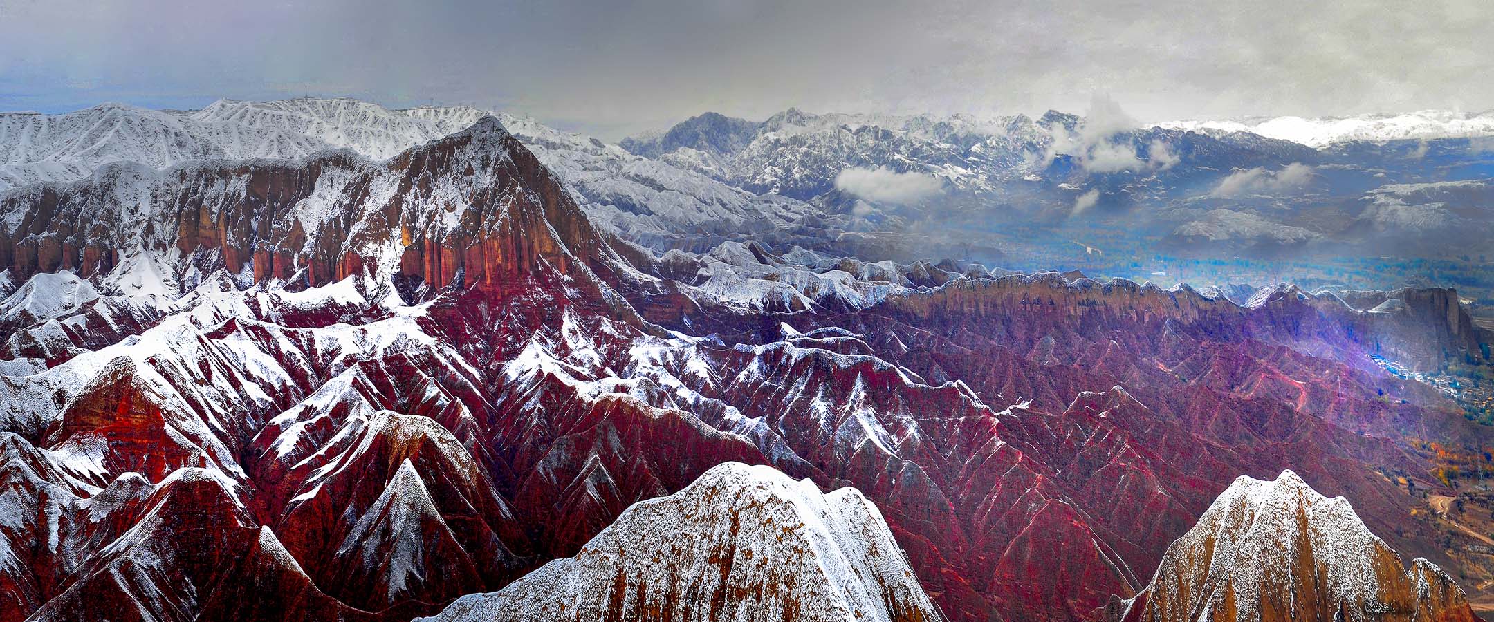
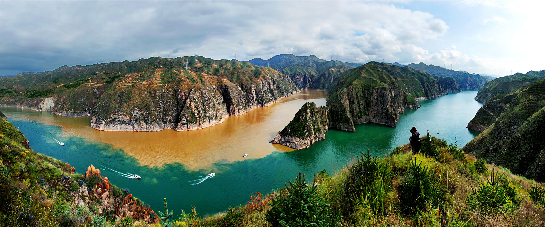
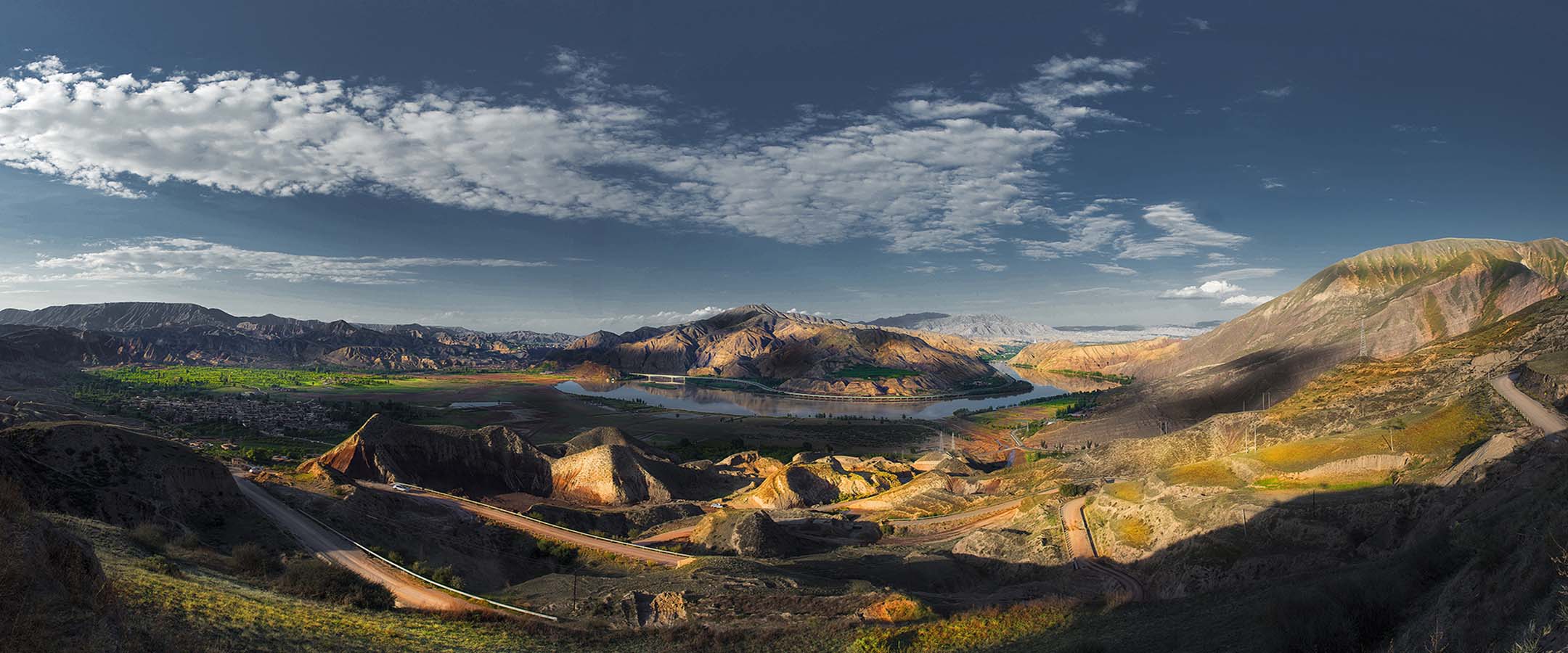
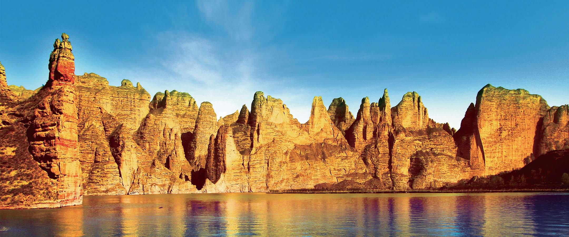


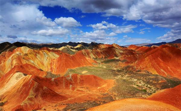
张掖世界地质公园位于中华人民共和国甘肃省张掖市境内,地理坐标为99°16'12”-100°07'37”E;38°40'52”-39°03’36”N,总面积1287.78平方千米。距离首都北京约1800千米,距离兰州约540千米。地质公园地处青藏高原向内蒙古高原跌落的第一级分界处,祁连山主脉北坡的中段,河西走廊的核心地带,属大陆冷温带干旱区,总的气候特征是年温差大,季节变化显著,降水稀少且分配不均,干燥多风。张掖国家地质公园北邻阿拉善地块,南接中祁连地块,属北祁连加里东褶皱带和阿拉善地块的过渡带。独特的地理位置和复杂的地质活动造就了地质公园内丰富而典型的地质遗迹,使得张掖国家地质公园成为一个集彩色丘陵、中国北方典型干早区红层地貌、九个泉蛇绿岩、中小型构造、火山熔岩地貌、流水侵蚀地貌、风景河段等为一体的综合性地质公园。2018年4月,湘西地质公园与张掖国家地质公园签订合作协议,正式结为姊妹公园。
Situated in Zhangye Municipality, Gansu Province, People’s Republic of China, Zhangye UESCO Global Geopark covers an area of 1,289.71 square kilometers. With geographical coordinates 99°16'12”-100°07'37”E;38°40'52”-39°03’36”N, it is about 1800 kilometers from capital Beijing, 540 kilometers from Lanzhou. Geographically, Zhangye Geopark is just located at the boundary between Qinghai-Tibet Plateau and Inner Mongolian Plateau, middle section of the north slope of Qilian Mountains, and core zone of Hexi Corridor. Belonging to arid region of continental temperate zone, the general climate feature of Zhangye are large annual temperature difference,distinct seasons, rare and uneven distributing rainfall, dry and windy. Zhangye Geopark bordersAlxa block to the north, Middle Qilian block to the south, locating at transitional zone from North Qilian Calidonian fold belt to Alxa block. Unique geographical location and complicated geological activities form rich and typical geoheritage in Zhangye Geopark. It is a comprehensive geopark consisting of colorful hill, typical arid-zone red bed landscape of north China, ophiolite suite,middle and small scale geological structure, volcanic lava landscape, water erosion landscape, scenery reaches. In April, 2018, Xiangxi Geopark singed sister geopark agreement with Zhangye Geopark and since then they became sister parks.
